Chamber of Revenue: Maps and drawings
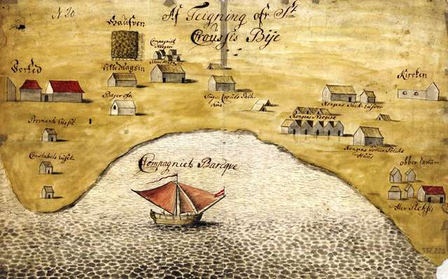
| Description | This contains maps and drawings from the former Danish colonies in the West Indies, Guinea, India and the Nicobar Islands. The collection is divided into two archives; The Chamber of Revenue (maps and drawings predating 1848) and the Central Directorate for the Colonies (maps and drawings postdating 1848). The material includes maps of each of the colonies, town maps, charts (especially for approaching harbors), draughts of coasts, prospects, and building designs for government facilities (for instance fortifications) including designs for building projects that were never carried out. In addition, there are a few photographs. |
|
| Extent | Documents: 254, Approved: 257 | |
| Complete |
Transskriptioner Transcriptions |
|
| Collection |
|
Content
| Name |
Transskriptioner Klar til indtastning |
Transskriptioner Ready for approval |
Approved Transskriptioner |
Transcriptions Klar til indtastning |
Transcriptions Ready for approval |
Approved Transcriptions |
Documents |
|---|